If you ask someone on the street about what there is to do in Bukit Timah, there’s a high chance that climbing Bukit Timah Hill will top the list. What many do not know is that Bukit Timah is also home to many other hiking trails, including one with a view above the Bukit Timah Expressway (BKE) en route.
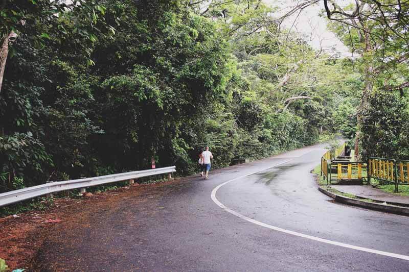
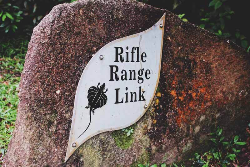
I’m not referring to the Eco-Link though – often overlooked, there is a hidden path only known to hiking and mountain biking enthusiasts along Rifle Range Road that offers an even better view of the BKE.
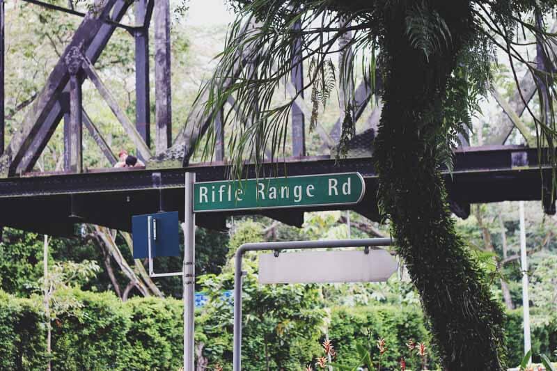
As ulu as it may sound, Rifle Range Road is in fact extremely accessible by public transport. After you exit King Albert Park Station (Downtown Line), it’s just a five to ten minutes walk to the entrance. You will definitely not miss it since the ‘insta-famous’ railway bridge is located right next to it as well.

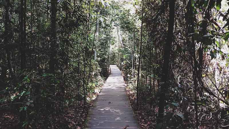
One aspect of this hiking route that I love is its suitability for hikers of all ages and proficiency levels, since it’s pretty much a straight path all the way in without any extremely steep up-slopes or obstacles. Therefore, once you turn into Rifle Range Road, you can relax and enjoy the stroll without having to do much navigation.


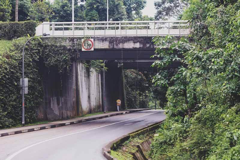
After trekking for approximately 30 minutes from the entrance of Rifle Range Road comes the highlight – being directly above the BKE! Although coming here in the day has its charms, I strongly recommend visiting after sunset as well for the full experience of seeing the expressway lit up at night.
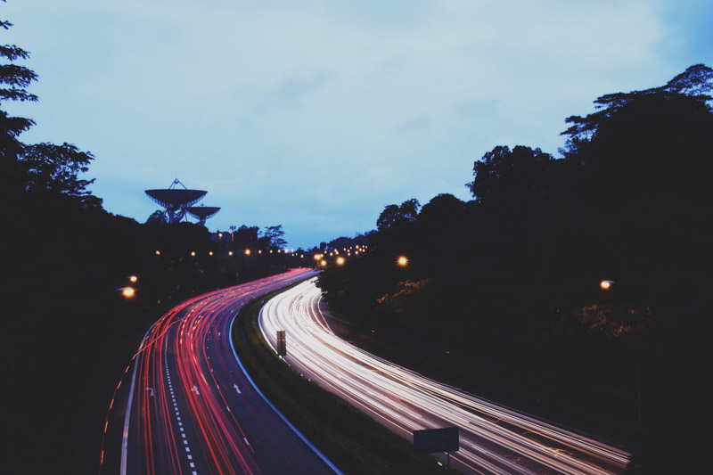
For photography enthusiasts, lights from passing vehicles make this a perfect spot for long exposure shots. Also, if you would like to try your hand at something different that can be taken even using your phone, an extreme bokeh shot is effortlessly aesthetic and easy to achieve as well.

When it’s dark, the camera finds it harder to focus. Thus, the trick to shooting this on your phone is to play around with the time that it takes for the camera to focus and just spam shots during that interval.
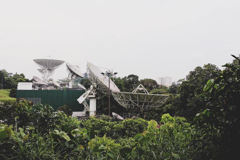
Commuting along the BKE frequently, I have seen these prominent satellite dishes on a regular basis. However, I could never manage to get a good shot since they are located at quite a distance.
If you have ever wanted to get close enough to snap a picture, this route will give you the perfect opportunity to do so. The dishes are located only a short walk away from the point above the BKE.

At the end of Rifle Range Road, you will see the entrance to MacRitchie Park. Having made it this far, why not push on and explore further?

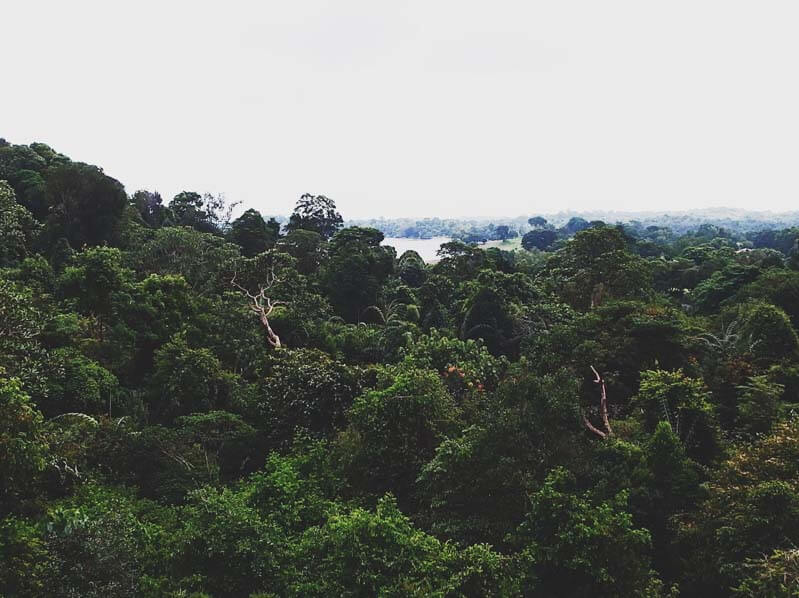
Located nearest to where we entered MacRitchie Park, Jelutong Tower boasts a bird-eye perspective of the entire nature reserve. Although it’s a steep six-storey climb to the top, the breathtaking view you will be rewarded with is definitely worth this intense leg day.
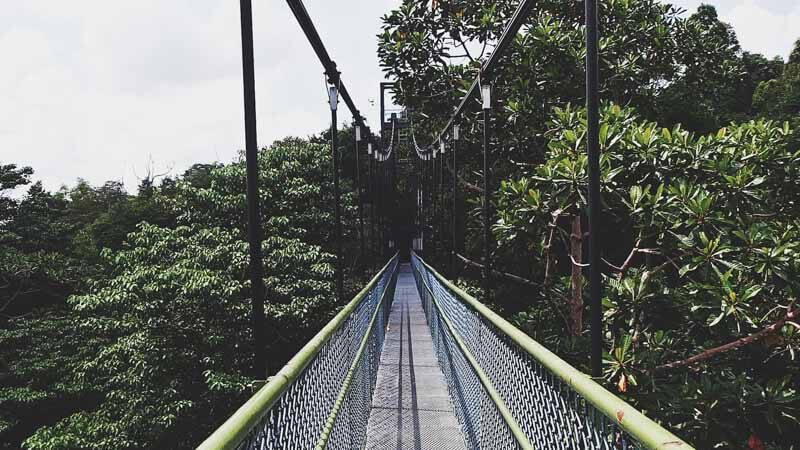
You can’t say you have visited MacRitchie without getting a picture on this suspension bridge that connects the two highest points of the park. The walkway brings you through the different stages of a mature secondary forest and varies in height with the peak at 25m, making this a great place for photos as well.
Congratulations explorer! Starting at the entrance of Rifle Range Road and ending in MacRitchie, you have now earned bragging rights for conquering a lesser-known hiking route in Singapore and taking enough photos to impress your friends on social media.
Give yourself a pat on the back and sayang your legs for their hard work.
Hiking Above The Bukit Timah Expressway (BKE): Start at Rifle Range Road, Singapore 588373
Author
Get the latest updates by following us on Twitter @hypeandstuff & Facebook Have an interesting story to share? Email us at [email protected]